Photos & Map
How would you like to arrive?
Description
Waypoints
Good to know
Nearby
- 2:50 h
- 8.78 km
- 400 m
- 430 m
- 504 m
- 856 m
- 352 m
- Start: St. Jakob
- Destination: Allweg
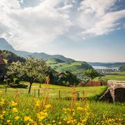
Over the "Drachenried" and over the "Alpnachersee". Passing farms and quite long in the shady forest. Unexpected panoramic views!
Waypoints
Start
Good to know
Best to visit
suitable
Depends on weather
Directions
From the bus station Ennetmoos, St. Jakob you pass the church and follow a meadow path to "Ebnet". At the "Rütli" we turn left towards the "Hinterbergwald" forest and reach the forest road, which leads us over the Alpnachersee, always slightly uphill. At the "Zingelkreuz" above the "Drachenflue" we are surprised by the impressive panorama. Below us now the "Drachenried", which got its name from the dragon that is said to have lived in a cave below the "Zingel". At the "Neumatt" we turn left and reach the edge of the "Ried", which we follow up to "Betti". From here it is not far to the Allweg monument, which commemorates the French attack of 1798. There is also a bus stop again (Ennetmoos, Allweg).
Directions & Parking facilities
Gut erreichbar mit dem Bus ab/bis Ennetmoos, Allweg
Additional information
More information:
Nidwalden Tourismus
Bahnhofplatz 2
6370 Stans
+41 (0)41 610 88 33
info@nidwalden.com
www.nidwalden.com
More hiking trails: nidwalden.com/hiking
Author
Nidwalden Tourismus
Organization
Nidwalden Tourismus
Nearby


