Photos & Map
How would you like to arrive?
Description
Waypoints
Good to know
Nearby
Download GPX file
- 0:25 h
- 2.31 km
- 18 m
- 18 m
- 569 m
- 587 m
- 18 m
- Start: Grafenort
- Destination: Grafenort
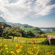
The trail is located at 569 m above sea level and offers a beautiful and easy trail on flat terrain, around 3 kilometres. Classic and skating. There is a cash desk on site for a contribution towards expenses.
Waypoints
Start
Destination
Good to know
Best to visit
suitable
Depends on weather
Tour information
Loop Road
Directions & Parking facilities
By train to Grafenort. Timetable
Author
Nidwalden Tourismus
Organization
Nidwalden Tourismus
Author´s Tip / Recommendation of the author
You should not miss a visit in the chapel Grafenort and at the Restaurant «Wirtschaft Grafenort».
Nearby


