Brennwald Tour

GPX

PDF

Bookmark

7.49 km long
Difficulty: easy
Hike
  • 02:15 h
  • 390 m
  • 275 m
  • 724 m
  • 1,083 m
  • 359 m
  • 7.49 km
  • Start: Emmetten, Sagendorf
  • Destination: Seelisberg, station (Treib-Seelisberg)
Emmetten – Brennwald – Höch Flue – Seelisberg

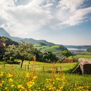
Many paths cross the forest between the cantons of Nidwalden and Uri. This hike leads through the Brennwald, a shady forest tour on hot summer days... and with a surprising view!

Waypoints

Start
Emmetten, Sagendorf
© Nidwalden Tourismus, Nidwalden Tourismus
Destination
Seelisberg, station (Treib-Seelisberg)

Good to know

Best to visit

suitable
Depends on weather

Directions

Many paths cross the forest between the cantons of Nidwalden and Uri. From the Emmetten-Sagendorf stop and the Heiligkreuz Chapel, the trail leads up to the forest, followed by a beautiful picnic place. In the middle of the Brennwald, we later take the path to the left, via "Farenblätz" to the interesting "Hohlweg" before "Litenfad". From "Höch Flue" you have an unexpected view of Seelisberg, Lake Lucerne and the two Mythen mountains. The little path down to the romantic chapel Maria Sonnenberg in  is well developed. At the end, a visit to the Aschwanden mountain cheese dairy in Seelisberg is recommended. 

Equipment

Eine gute Ausrüstung inkl. Regen- und Wärmeschutz ist empfohlen.

Additional information

More information:

Nidwalden Tourismus
Bahnhofplatz 2
6370 Stans
+41 (0)41 610 88 33
info@nidwalden.com
www.nidwalden.com


More hiking trails:  nidwalden.com/hiking

Author

Nidwalden Tourismus

Organization

Nidwalden Tourismus

Nearby

Getting there
Brennwald Tour
6376 Emmetten